Creative Applications of Plat Maps in Modern Contexts
Key Takeaways
- Plat maps are being transformed into powerful and artistic communication tools for property development.
- Interactive digital maps are elevating engagement across real estate, tourism, and public information.
- Digitization of plat maps is broadening access and driving new civic and cultural applications.
Plat maps have evolved far beyond their traditional role as static diagrams for recording property boundaries. Today’s plat maps underpin a surprising array of creative and practical uses, reflecting advances in technology and shifts in community engagement. These innovative applications span real estate marketing, urban planning, interactive tourism, and even digital storytelling—all fueled by the detail and flexibility that plat maps provide. Increasingly, online platforms offer powerful ways to visualize and explore land ownership; a land owner map is now a central tool for anyone navigating property boundaries or neighborhood planning in a digital age.
Plat maps balance design and function, acting as legal records, visual tools, and community projects. Digitization enhances transparency and aids land decisions, reducing conflicts. They also support 3D visualization and storytelling, enriching cultural experiences. Municipalities and professionals adopt global mapping innovations.
Artistic Visualization in Real Estate
Real estate developers and marketing firms have reimagined the plat map as an expressive, visual tool for storytelling and brand differentiation. No longer confined to black-and-white schematics, modern artistic plat maps integrate color coding, custom illustration, and highlighted amenities to communicate complex development layouts. These visually-driven maps draw in buyers and make real estate offerings immediately understandable, fostering a deeper and more emotional connection with the property. Successful campaigns often combine technical precision with graphic creativity, ensuring buyers see not just the boundaries, but the possibilities the property holds.
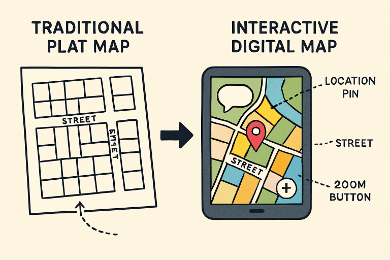
Interactive Maps for Enhanced Engagement
The shift toward interactive online plat maps is one of the most transformative trends in the industry. Home seekers, for example, can explore available lots, quickly filtering by criteria like price, size, or proximity to parks and schools, within an engaging interface that reflects real-world context. Likewise, city planners and tourism boards use interactive maps to guide users through thematic trails, historical walks, and local events, personalizing the mapping experience.
Digitization for Public Accessibility
Government agencies and advocacy groups are working to digitize historical plat records, making them readily accessible online. These efforts improve transparency, streamline land transactions, and enhance public safety by clarifying property lines. Recent legislative measures, such as those dedicated to digitizing public land maps, underscore the societal value of easily accessible, accurate property data. Digital plat maps empower communities to manage growth, plan new infrastructure, and mitigate disputes involving land use or access rights.
Community Storytelling Through Maps
Cultural preservationists and local historians have found new uses for plat maps in storytelling and education. By overlaying 3D models, photos, or archived objects onto the original map features, institutions can bridge past and present, showing how communities have changed over generations. This geo-contextual storytelling helps visitors “walk through history,” making geography a living thread that binds art, tradition, and memory together. These interactive platforms foster a sense of place and belonging—essential components for meaningful community engagement.
Real-Time Event Documentation
Digital plat maps can also serve as dynamic hubs for live information flow. Journalists, emergency responders, and organizers are utilizing real-time geodatabase technology to track unfolding events, ranging from natural disasters to public demonstrations. With instant visual documentation and updates, maps have become essential tools for making timely decisions and communicating effectively with the public. During emergencies, these systems enhance the ability to direct resources, track changes, and convey accurate information as situations unfold on the ground.
Conclusion
The modern plat map’s journey from static legal document to vibrant, interactive tool highlights its growing significance in urban innovation, digital engagement, and civic transparency. Whether helping buyers visualize a future neighborhood, allowing communities to share their stories, or enabling the public to track events as they unfold, plat maps sit at the center of how we relate to, manage, and cherish our shared landscapes.